The May 3rd magnitude 3.8 earthquake is not unusual for the Los Angeles basin region. (Note that the magnitude was revised from M3.9 to M3.8 once all information was available.)
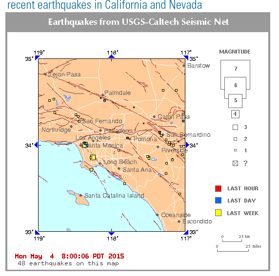
The 2015 seismicity along the northern greater Newport-Inglewood fault zone so far includes three events of magnitude greater than 3.0.
- 13 April 2015: M3.3 in the Baldwin Hills at depth of 7.3 miles
- 30 April 2015: M3.4 near Carson at depth of 9.1 miles
- 3 May 2015: M3.8 near View Park (Inglewood) at depth of 7.5 miles
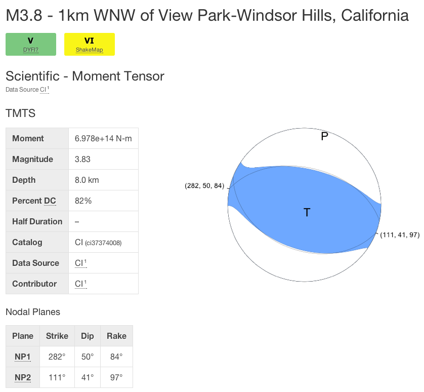
The first two events showed movement consistent with horizontal motion in the Newport-Inglewood fault zone.
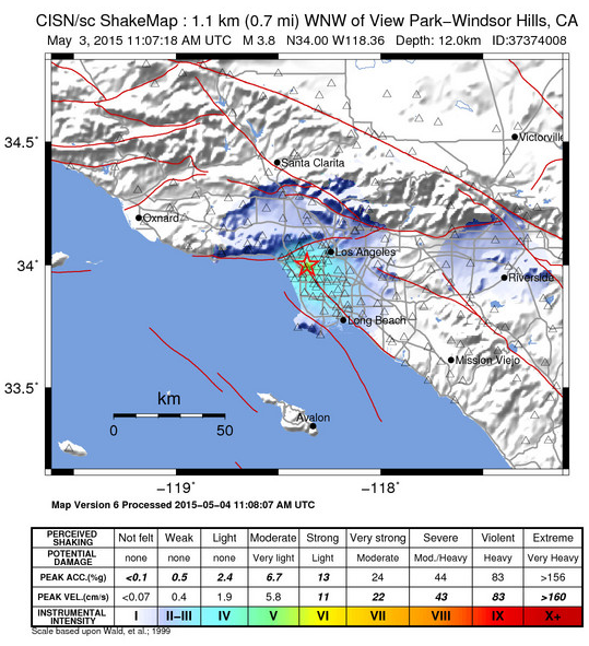
The May 3rd event is different, and showed vertical motion on an almost east-west striking fault segment. This mechanism suggests that the event was not on a main fault strand of the Newport-Inglewood fault zone. It might have occurred on a compressive step-over in the greater Newport-Inglewood fault zone.
All of these events had very few aftershocks, which is often observed for small quakes in the Los Angeles basin.
This is a reminder that the greater Los Angeles basin has earthquakes, some of which have been larger than the May 3rd event. Earthquakes in the magnitude 3 to 4 range happen every year. In the 1980s and 1990s a number of moderate-sized earthquakes occurred in the basin, including the 1987 M5.9 Whittier Narrows, 1991 M5.8 Sierra Madre and 1994 M6.7 Northridge earthquakes.
The last larger earthquake in this region (located near Inglewood) occurred 17 May 2009, and had a magnitude 4.7.
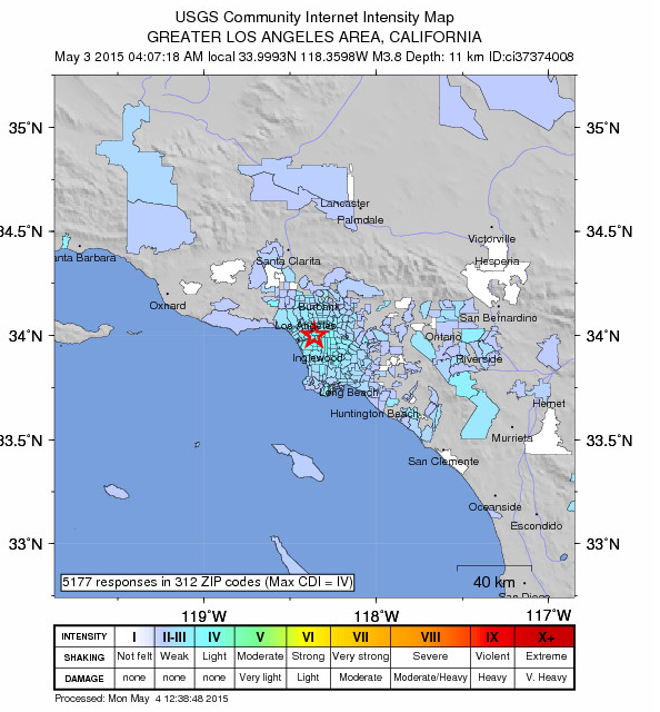
The May 3rd event was felt across Los Angeles and Orange counties.
The Newport-Inglewood fault zone (NIFZ) extends from Newport Beach in the south, across Long Beach, to Beverly Hills in the north for a distance of approx. 45 miles or 70 km. It has a geological slip rate of approx. 1 mm/yr, and could accommodate a M7 earthquake. Through geological time numerous oilfields have formed along the fault as geometrical complexitites have created anticlines in the basin sediments, forming traps for oil. Many of these oil fields have been in active production for more than 80 years. Previously, the NIFZ accommodated the 1933 Mw6.4 Long Beach earthquake.
We are not able to comment on fracking because we do not have information about industrial activities within the oilfields. However, because these events are deep, they are more likely to be related to tectonics along the plate boundary than human activity.
The prototype earthquake early warning system (ShakeAlert) provided 4 seconds of warning for Pasadena, and an estimated event magnitude of M3.7 (read more).
Peak ground shaking of 13.4g was recorded by a CGS station 4.4km away at Manchester & Osage. We are not aware of any reported damage.
See also
Mainshock Details:
| Magnitude | 3.8 – local magnitude Ml |
| Time | Sunday, May 3, 2015 at 04:07:18 AM (PDT) Sunday, May 3, 2015 at 11:07:18 (UTC) |
| Distance From | Baldwin Hills, CA – 1 km (1 miles) ESE (112 deg.) Culver City, CA – 4 km (2 miles) E (91 deg.) Inglewood, CA – 5 km (3 miles) NW (321 deg.) Los Angeles Civic Center, CA – 12 km (8 miles) WSW (239 deg.) |
| Coordinates | 33 deg. 60.0 min. N (33.999N) 118 deg. 21.6 min. W (118.360W) |
| Depth | 12 km (7.5 miles) |
| Quality | Good |
| Location Quality Parameters | Number of stations: 158 Number of phases: 202 Closest station: 1 km Travel time residual: 0.28 sec Horiz. error: 0.2 km Vert. error: 0.3 km Az. gap: 25.2 degrees |
| Event ID # | ci37374008 |
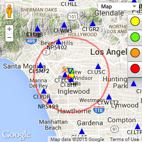
Aftershocks for the 3 May 2015 M3.8 mainshock, as of 08:00 am May 4th 2015:
- M1.4 2015/05/03 22:10:15 33.995N 118.331W Depth 9.5, 4km (2 mi) N of Inglewood, CA
- M1.8 2015/05/03 12:51:57 34.008N 118.356W Depth 10.3, 2km (1 mi) ENE of Baldwin Hills, CA
- M1.5 2015/05/03 11:09:29 34.024N 118.367W Depth 7.8, 2km (1 mi) N of Baldwin Hills, CA
Aftershocks for the 30 April 2015 M3.4 mainshock, as of 08:00 am May 4th 2015:
- M1.2 2015/05/01 00:58:41 33.851N 118.282W Depth 16.9, 2km (1 mi) N of Carson, CA
Shake Alert Performance
While the May 3rd event wasn’t a big earthquake, it provided a foretaste of ShakeAlert capabilities in the L.A. Basin for the Newport-Inglewood fault.
Given the event depth of 7.5 miles (12 km) and an assumed shear wave velocity of 3.5 km/s, source to surface, there was no blind zone for this event.
- First alert: Elarms, 5 stations, 3.3s after origin time, M3.3
- Elarms 1st report: 11:07:21.4, 3.3s after origin time, M3.3
- Onsite 1st report: 11:07:24.5, 6.4s after origin time, M4.9
- VS 1st report: 11:07:27.6, 9.5s after origin time, M3.6