
A Mw5.8 earthquake occurred at 10:48AM near the US/Mexico border, 22 miles SE of Calexico, CA, in northern Baja CA, Mexico. The event was felt widely throughout Southern California and northern Baja, and felt as far away as Arizona.
Report by the California Integrated Seismic Network (Caltech/USGS), Ken Hudnut (USGS)
Update 12/30/09 13:40 PST
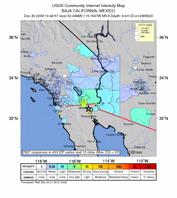
A magnitude 5.8 earthquake struck southeast of Mexicali, Mexico, about 35 km south of the US-Mexico border, at 10:48 a.m. Pacific time (PST); it was widely felt in Mexico, southern California and southwest Arizona. Location: 32.467°N, 115.195°W

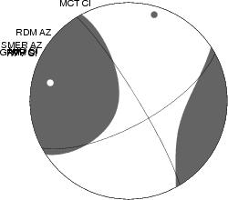
The earthquake likely involved motion along a zone of faults distinct from, but running parallel to, the San Andreas fault. These faults accommodate right-lateral motion of the Pacific Plate, which moves northwestwards relative to the North American plate. Earthquakes with up to M 6 have happened historically in this vicinity, but most recent earthquake activity is slightly farther to the southwest near Cerro Prieto. This event appears to have occurred along a southeastward projection of the Imperial fault, slightly northeast of Cerro Prieto and within the Colorado River delta.
Within half an hour after the event, over 7,000 felt reports from 428 zip codes in the US and 11 cities in Mexico with maximum intensity of VI (strong shaking) had been received by USGS. The USGS revised PAGER estimate is about 1000 people exposed to severe (MMI VIII) shaking, nearly 200,000 to strong to very strong shaking (MMI VI-VII) and nearly 1 million exposed to moderate shaking (MMI V). The largest aftershock has been a magnitude-4.8.
No unusual earthquake activity has been observed to the north of the US-Mexico border yet in association with this activity.
Links to additional information:
- https://earthquake.usgs.gov/earthquakes/eventpage/ci14565620
- http://neic.usgs.gov/neis/eq_depot/2009/eq_091230_ci14565620/ci14565620_m.html
- https://earthquake.usgs.gov/earthquakes/eventpage/ci14565620#pager