
Beyond locations and magnitudes, and the collation of the earthquake catalog, SCSN creates a number of additional ‘products’. These are distributed through the Southern California Data Center (SCEDC) and our other partners to make them available to scientific researchers and the wider public. These include:
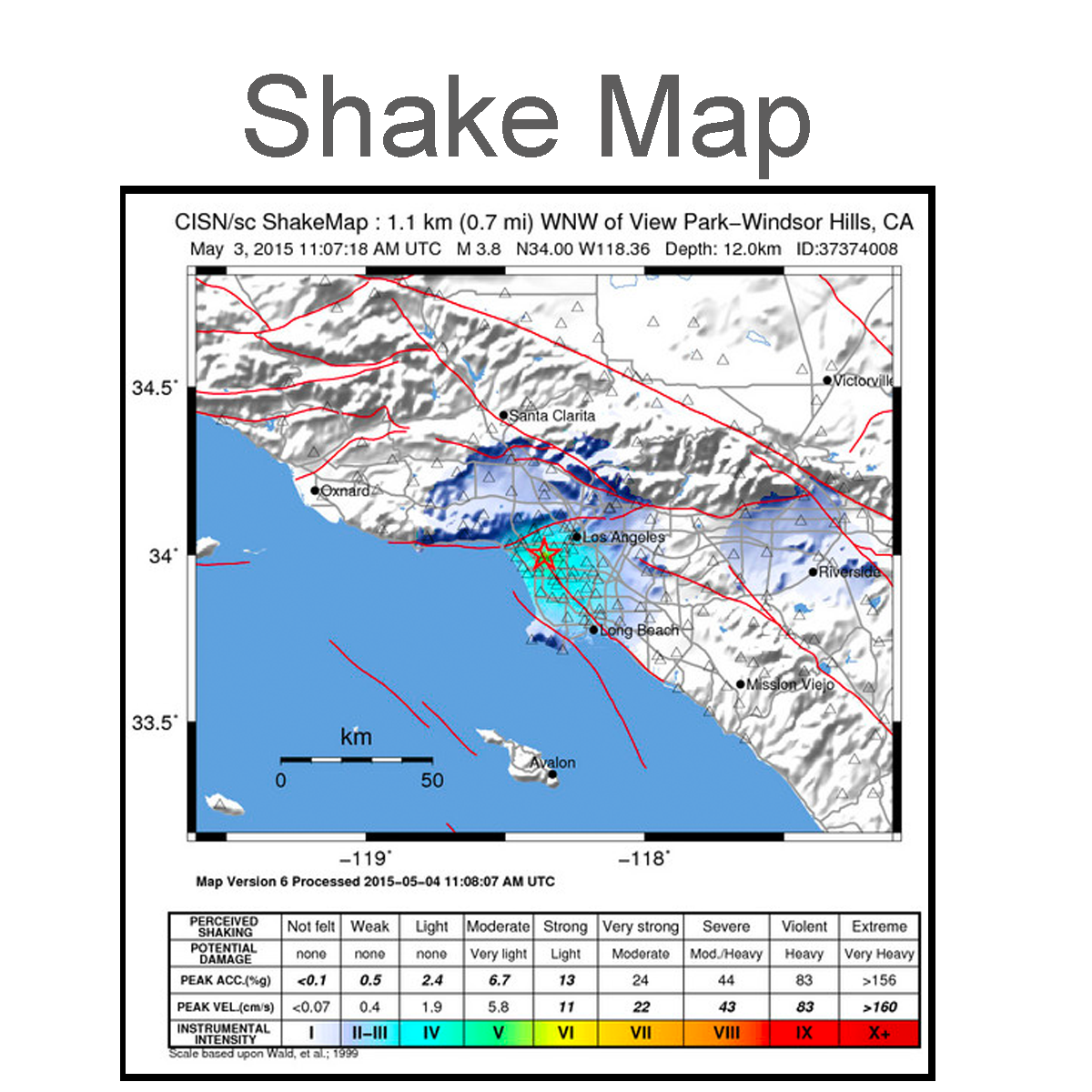 |
ShakeMaps are maps that provide the visual distribution of ground motion and shaking intensity following a significant earthquake. They’re used for post-earthquake response and recovery, public and scientific information, as well as for preparedness exercises and disaster planning. |
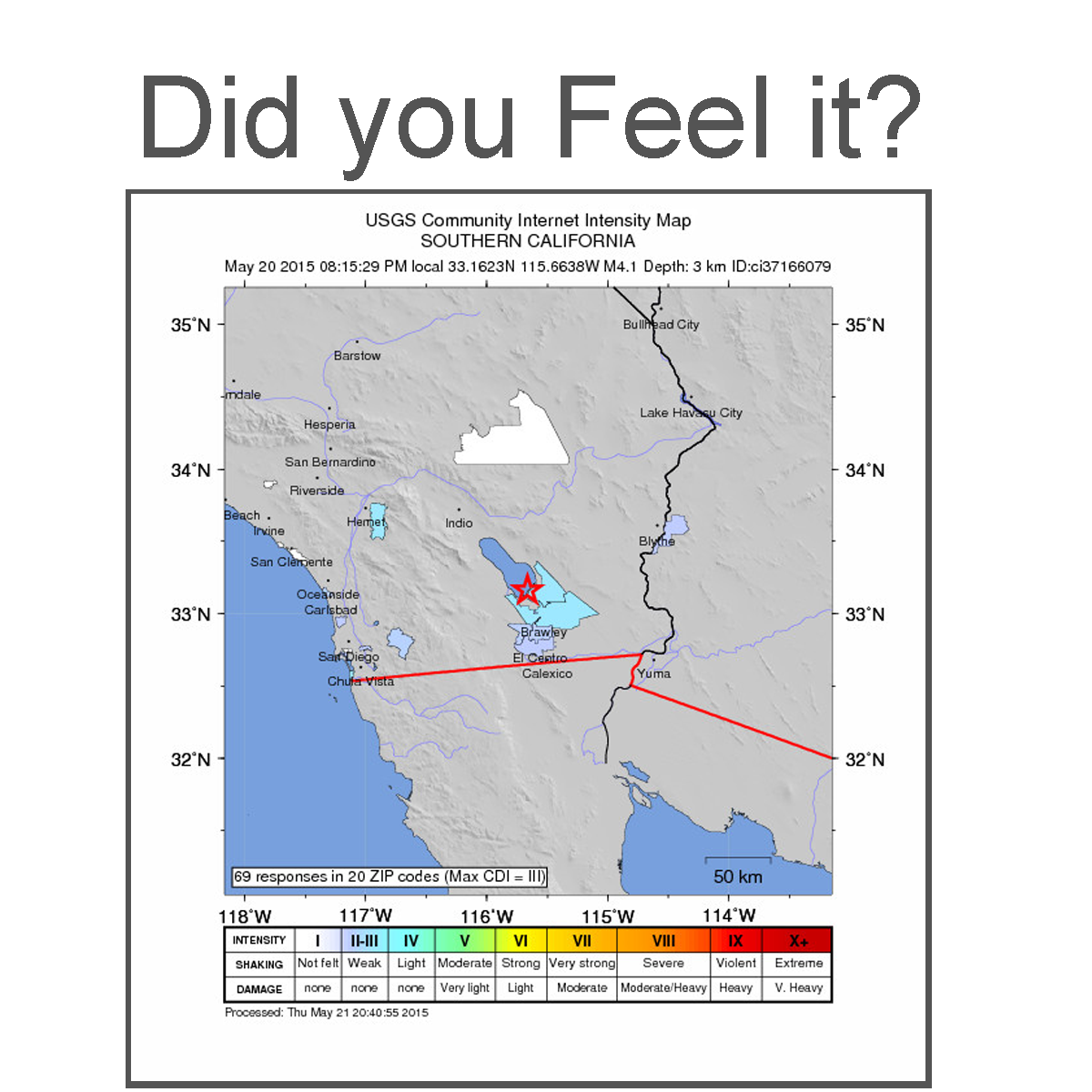 |
Contribute your experience of an earthquake and add to the scientific body of information by filling out a “Did You Feel It?” report. Submit valuable information on the extent of ground shaking and damage and ensure your area has been represented in the compilation of the community intensity map. |
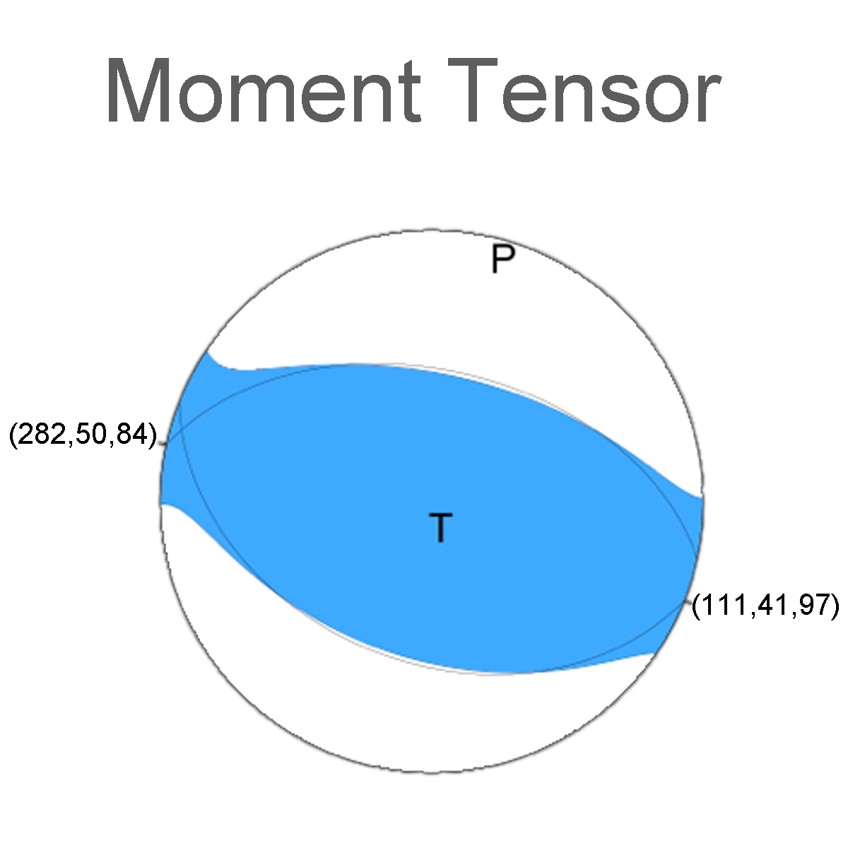 |
Moment tensor is a mathematical representation of the movement on a fault during an earthquake. Often referred to as the “beach ball”, the tensor depends on the source strength of the earthquake and its fault orientation. |
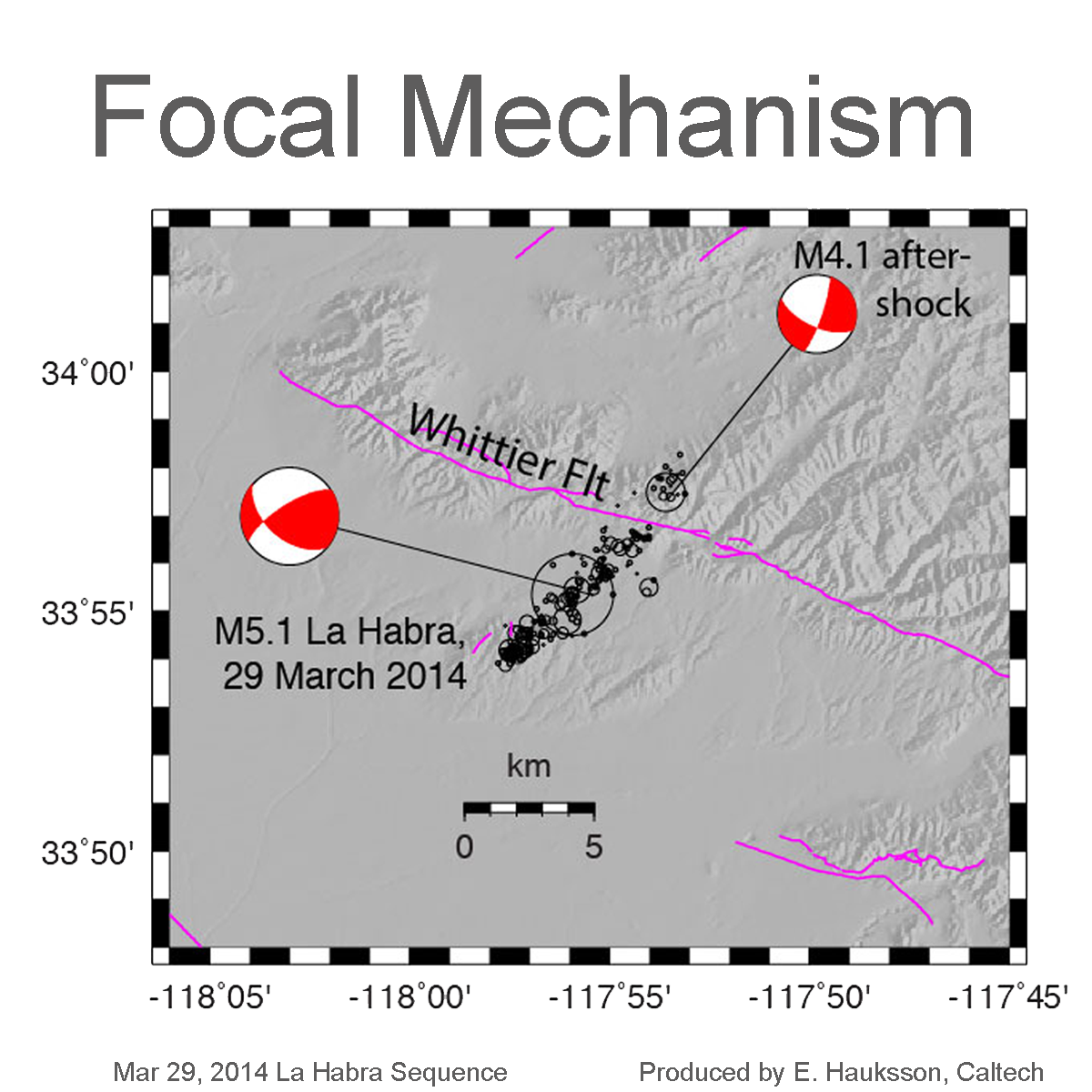 |
The Focal Mechanism is similar to the Moment Tensor, but it uses the first motions (ups and downs) of the earthquake’s P-wave to determine the fault’s movement and orientation. |
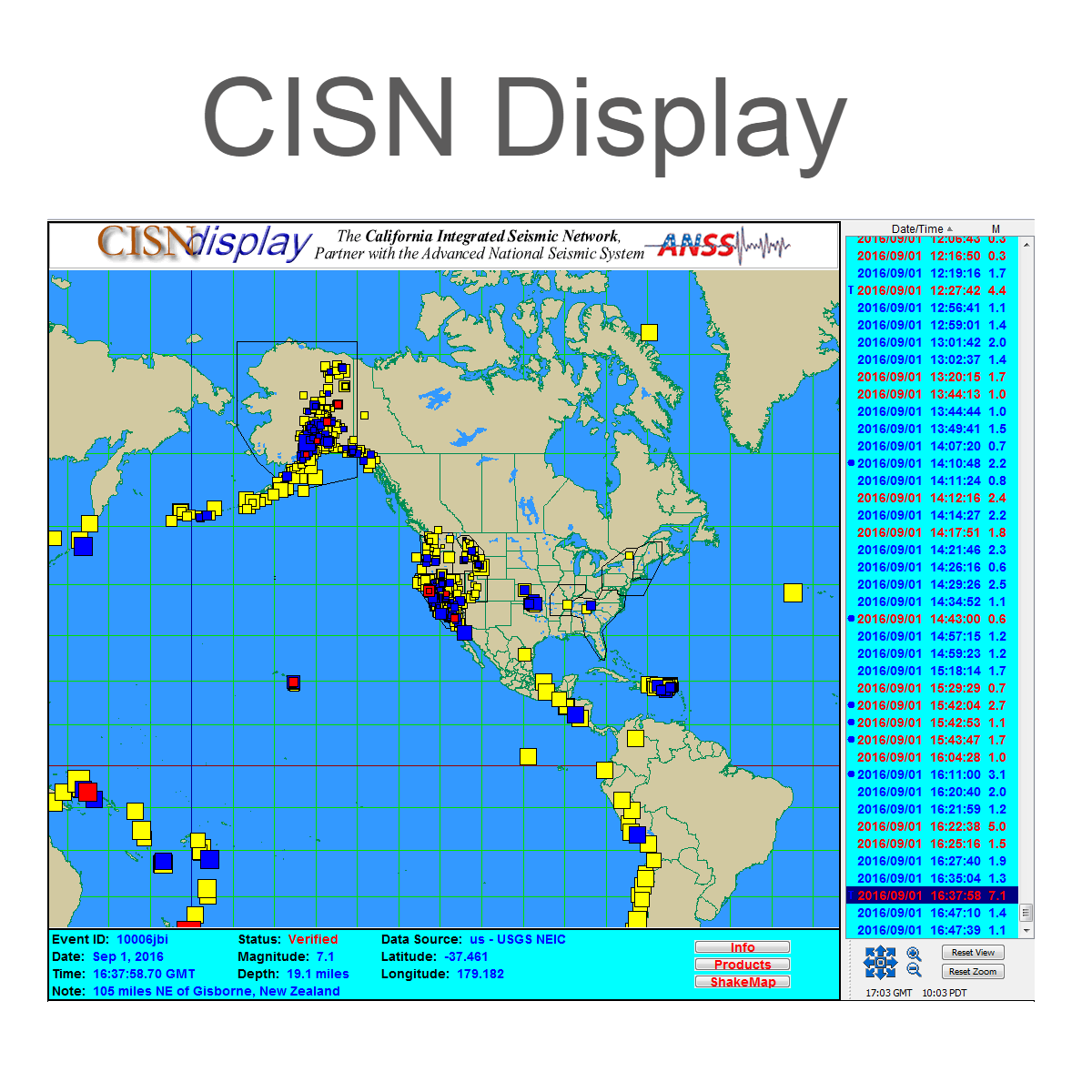 |
As part of the California Integrated Seismic Network (CISN) partnership, one of the primary means of distributing SCSN earthquake data to our partners and emergency managers is through the CISN display. The display uses SCSN’s submitted data to continuously report any significant earthquake activity in California. The CISN display is now managed by the California Geological Survey (CGS). |
| SCEDC | Data from the SCSN, including earthquake catalog, station and waveform data, can be obtained through the Southern California Data Center (SCEDC). |