
Last updated October 4th, 2019
- 06 Jan 2016 06:42:34 PST, (33.958, -116.888), depth 16.7km, 4km NNW of Banning, California
- Aftershocks: so far (06 Jan 2016, 9:10am PST) there has been 1 aftershock recorded, M1.0. Some may be expected in the next few days, the largest expected is approximately 1 magnitude unit smaller than the mainshock. There is a small chance (about 5%) that a larger quake could occur, with the likelihood decreasing over time.
- Historical seismicity: since our records began in 1932 we’ve had 2 events of M4 or greater within 10km of today’s event, the largest was M4.9 (1946/09/28) and the most recent was M4.3 on 12 Jan 2010.
- Nearby faults: San Andreas fault zone, San Bernardino Mountains section (Banning fault) (0.7 km), San Gorgonio Pass fault zone (San Gorgonio Pass fault) (2.1 km), San Andreas fault zone, San Bernardino Mountains section (Gandy Ranch fault) (2.7 km), San Andreas fault zone, San Bernardino Mountains section (Banning fault B) (4.7 km), San Andreas fault zone, San Bernardino Mountains section (South Branch SAF) (4.7 km), San Andreas fault zone, San Bernardino Mountains section (5.0 km), Beaumont Plain fault zone (8.2 km), San Jacinto fault zone, San Jacinto Valley section (11.5 km) and San Jacinto fault zone, San Jacinto Valley section (Claremont fault) (16.2 km).
- Links for: USGS earthquake page, ShakeMap, DYFI.
- Visit our special reports page for further information on local notable earthquakes.
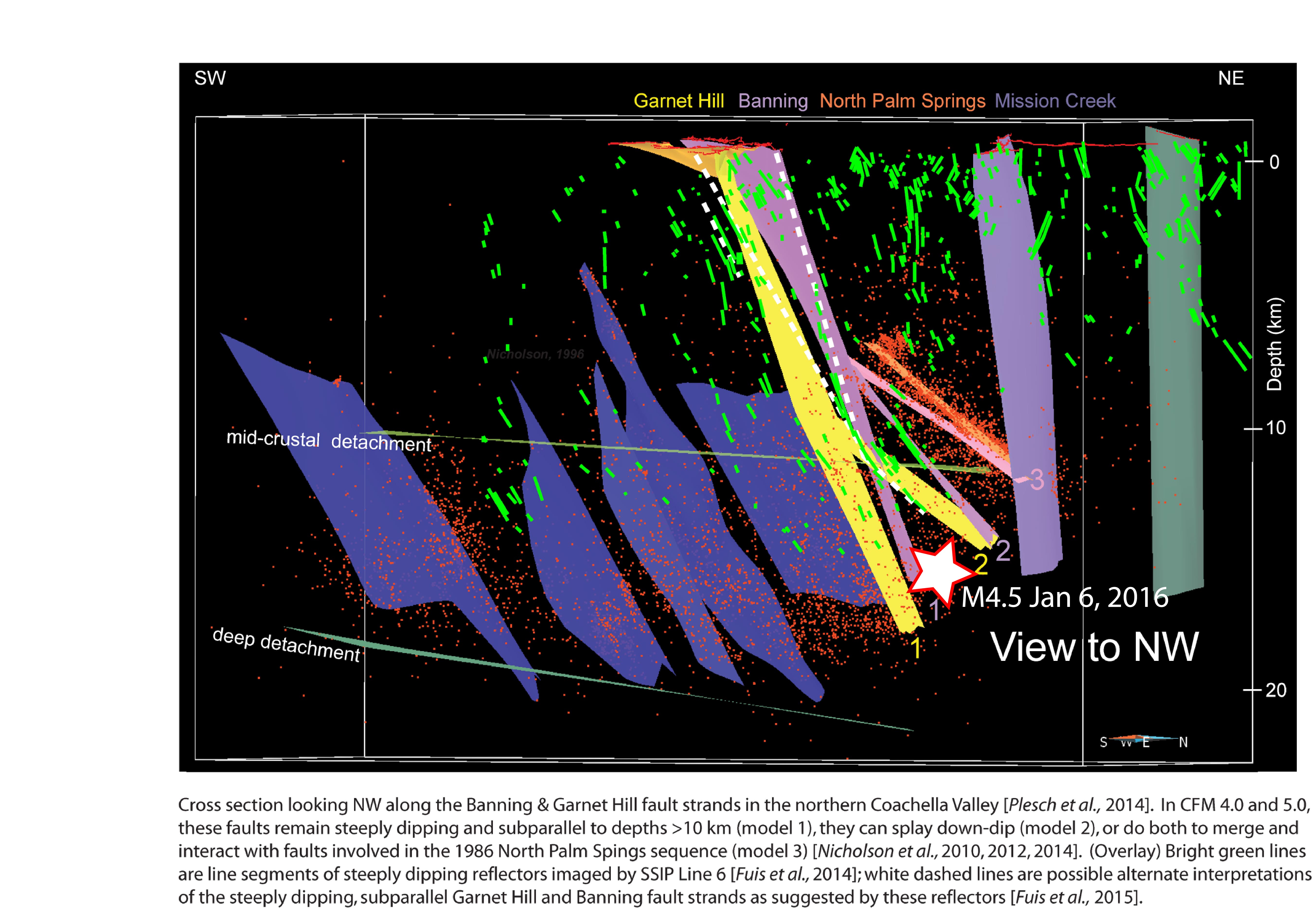
The M4.4 earthquake on 6 Jan 2016 was located in the middle of this cross section at 16 km depth (shown as a white star with red edges). The tectonics in this region are complex with many intersecting faults. Cross section courtesy of Craig Nicholson, UCSB


